June 14, 2016
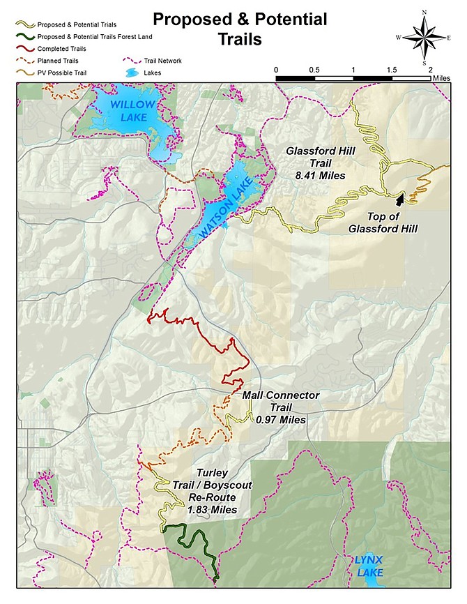
This map from the City of Prescott shows proposed and potential trails: yellow lines denote proposed and potential trails; green, proposed and potential trails on forest land; red, completed trails; brown dashes, planned trails; brown solid, possible Prescott Valley trail; and pink dashes, existing trail network.
Stories this photo appears in:

Glassford Hill, the Turley Trail, and vacant land near the Prescott Gateway Mall could all have improved trail access soon – the first of multiple anticipated results of a move by the Prescott City Council this past week.
By Cindy Barks
June 15, 2016